Dr. Ian Church and Dr. Kevin Wilcox:
Dr. Kevin Wilcox in front of Cape Horn aboard the Margaret Brooke during the Canadian Antarctic Research Expedition, March 2025 / Photo: Kevin Wilcox
by Jamie Contos
On the precedent-setting expedition of a Canadian naval vessel into Antarctic waters, a cross-country collaborative research effort furthered Canada’s scientific understanding of polar waters and climate
Ocean floor mapping comes with a unique set of challenges, resulting in only 25% of the world’s oceans having been mapped. Despite the difficulties surrounding it, ocean mapping is an essential form of research and provides pivotal information to a variety of marine professionals; from geologists, to oceanographers, to navigators.
Out of the University of New Brunswick, Principal Investigator, Dr. Ian Church, and Research Scientist, Dr. Kevin Wilcox, with the Ocean Mapping Group, are dedicated to improving the way that ocean floor data is both collected and processed.
During the 2025 Canadian Antarctic Research Expedition aboard the HMCS Margaret Brooke, the Ocean Mapping Group was able to collect indispensable data in a remote location.
Joining the Canadian academic delegation of scientists, Dr. Wilcox was able to survey and gather data from multiple locations, including the caldera of Deception Island in Port Foster and the southwestern edge of Keller Peninsula in Admiralty Bay.
Over its last 35-years of operation, the majority of the Ocean Mapping Group’s data has been collected from the Canadian Arctic, making the Antarctic expedition an ideal opportunity to gain new insights using both tried and true methodologies and tools as well as some new ones.
“We were looking forward to gaining a better understanding through this opportunity to test the ways that we’ve done things in the Arctic down in the Antarctic, but also had to come up with some new solutions because of that environment,” explained Dr. Church.
“One thing we were able to do was collect new mapping data about the seafloor in areas that haven't been covered before.”
Light doesn’t transmit through water well, especially in murky or deep areas, meaning it isn’t possible to see the ocean floor with satellites, cameras, or other light based systems. Sonar is essential when mapping the ocean floor.
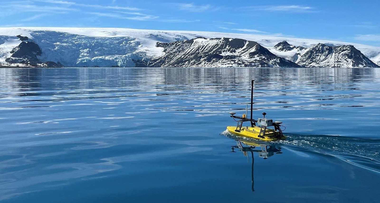
Within the last six years, the Ocean Mapping Group has started employing the use of uncrewed surface vessels to gather sonar data, however they had not yet been used in the Canadian Arctic. This expedition provided an opportunity to use autonomous vessels to collect useful seafloor mapping data aboard a vessel of opportunity.
During the expedition, Dr. Wilcox was able to operate an uncrewed surface vehicle equipped with multibeam sonar technology to create 3D models of the ocean floor. This is achieved by sending out a sound pulse into the water, which then hits the seabed before reflecting back up, allowing the return time of the pulses to be measured in hundreds of directions.
These efforts do not only serve to advance data collection techniques, but contribute to a broader effort to better understand underwater geological structures like submerged shorelines and marine glacial fronts which can inform many avenues of ocean research when made accessible.
“The big focus for us is trying to make sure that data that we’re collecting is as useful and as trustworthy as possible for anybody else who might want to use it to answer any other questions about the ocean environment,’ Dr. Church concluded.
“An opportunity like this doesn't come along very often, and a lot of people and a lot of science has benefited from this, and it has created new opportunities to take Canadian research further at an international level.”
To learn more about the Canadian academic delegation, as well as the important research that came out of the Antarctic expedition, follow MEOPAR: Marine Environmental Observation, Prediction and Response Network on LinkedIn.
